 Empowering Smarter Decisions Through Geospatial Intelligence
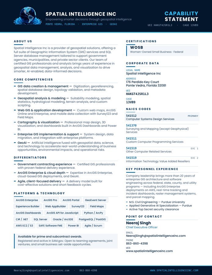
GIS data creation & management
Digitization, georeferencing, spatial database design, topology validation, and metadata development.
Empowering smarter decisions through geospatial intelligence
Spatial Intelligence Inc builds the enterprise GIS systems that turn location into an advantage — for federal agencies, municipalities, and the primes who serve them.
Core competencies
We handle geospatial data management, analysis, and visualization end to end — and hand back systems your team can actually run.
Digitization, georeferencing, spatial database design, topology validation, and metadata development.
Suitability modeling, spatial statistics, hydrological modeling, terrain analysis, and custom scripting.
Custom web maps, ArcGIS Online and Enterprise deployments, and mobile data collection with Survey123 and Field Maps.
Professional map design, 3D visualization, and decision dashboards built in ArcGIS Dashboards and Power BI.
System design, data migration, and integration with the enterprise platforms your organization already runs on.
Artificial intelligence fused with geospatial data and science to accelerate understanding of business opportunities, environmental impacts, and operational risks.
Capability statement
Current as of this year, formatted for federal and state review, and ready to attach to a solicitation package.
Differentiators
Certified GIS professionals with proven delivery on federal programs — we know the review cycles, the security posture, and the documentation.
Deep expertise in ArcGIS Enterprise, cloud-hosted GIS deployments, and GeoAI — including Server, Portal, and GeoEvent on AWS.
Short cycles, working software in front of stakeholders early, and a cost-effective model that scales to the size of the task.
Leadership
Spatial Intelligence Inc is led by an enterprise GIS architect and software engineer with more than two decades designing, building, and administering geospatial systems — ArcGIS Server, Portal, and GeoEvent environments on AWS; Python and ArcPy automation; enterprise geodatabase design in Oracle, SQL Server, and PostgreSQL/PostGIS; and web mapping with the ArcGIS API for JavaScript.
That work has spanned federal programs, state and county government, and utility clients — from real-time tracking and incident dashboards to raster management systems and parcel mapping.

Chief Executive Officer
Corporate data
NAICS codes
541512Computer Systems Design Services — primary541370Surveying and Mapping (except Geophysical) Services541511Custom Computer Programming Services541519Other Computer Related Services · exception 1541519Information Technology Value Added Resellers · exception 2Contact
Solicitations, teaming, subcontract opportunities, or a straight question about a dataset — write to us directly.
NeerajSingh@spatialintelligenceinc.com